The Higher or Eastern Dyffryn Cromlech
Introduction
The photograph on this page of The Higher or Eastern Dyffryn Cromlech by Eric Jones as part of the Geograph project.
The Geograph project started in 2005 with the aim of publishing, organising and preserving representative images for every square kilometre of Great Britain, Ireland and the Isle of Man.

There are currently over 7.5m images from over 14,400 individuals and you can help contribute to the project by visiting https://www.geograph.org.uk
The Higher or Eastern Dyffryn Cromlech
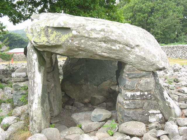
Image: © Eric Jones Taken: 20 Jul 2006
The second, of two, chambers on this important archaeological site. It stands 10m east of the first chamber and represents a separate phase in the development of this Neolithic tomb. The capstone stands on five uprights and is 3.5m long and 3m broad. A modern pillar has been built to help support the capstone.
Images are licensed for reuse under creativecommons.org/licenses/by-sa/2.0
Image Location
Latitude
52.785178
Longitude
-4.093641