Mansfield - Berry Hill Hall
Introduction
The photograph on this page of Mansfield - Berry Hill Hall by Dave Bevis as part of the Geograph project.
The Geograph project started in 2005 with the aim of publishing, organising and preserving representative images for every square kilometre of Great Britain, Ireland and the Isle of Man.

There are currently over 7.5m images from over 14,400 individuals and you can help contribute to the project by visiting https://www.geograph.org.uk
Mansfield - Berry Hill Hall
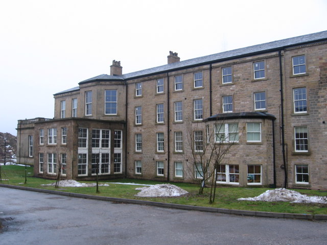
Image: © Dave Bevis Taken: 14 Dec 2010
An early 18th century country house, with large scale additions built for William Bilbie in around 1770. A new south wing was added in the early 19th century, with a central pediment. Further additions were made in the 19th and mid 20th century. The building was used until about 1990 as a miners' rehabilitation centre. The Hall subsequently fell into disrepair, but is now (2010) being converted into apartments. See also http://www.nottinghamshire.gov.uk/bar-mansfield.pdf.
Images are licensed for reuse under creativecommons.org/licenses/by-sa/2.0
Image Location
Latitude
53.13037
Longitude
-1.178849