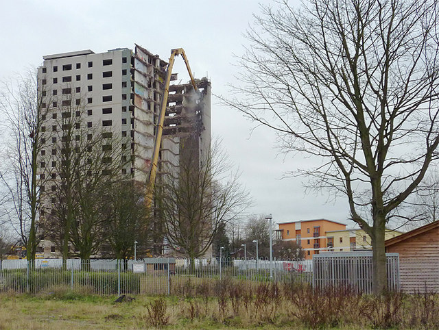
Demolition of Phoenix Rise in Blakenhall, Wolverhampton
Introduction
The photograph on this page of Demolition of Phoenix Rise in Blakenhall, Wolverhampton by Roger D Kidd as part of the Geograph project.
The Geograph project started in 2005 with the aim of publishing, organising and preserving representative images for every square kilometre of Great Britain, Ireland and the Isle of Man.
There are currently over 7.5m images from over 14,400 individuals and you can help contribute to the project by visiting https://www.geograph.org.uk

Image: © Roger D Kidd Taken: 10 Dec 2010
This image is the scene viewed from the derelict land left from an earlier demolished block. There were six tower blocks originally, Phoenix Rise being the last to be dispensed with, leaving only memories of ill conceived 1960s housing policy. The south end of the tower, fully wrapped to prevent stray material falling outside the building perimeter, was removed very slowly, bit by bit, using a large skip hung from a tower crane to lower debris to the ground for subsequent removal. With utilities rather too close, neither explosive demolition nor the risk of falling debris were options. Image In this image, seen here with telephoto assistance, the north end is being taken down rather more quickly by heavier machinery, the debris and dust falling directly to the ground past unprotected walls. A conversation with one of the demolition gang revealed that this north end will probably be cleared before Christmas, the centre section being left until early January 2011. See also this 2008 image from the other side: Image

