The Strait, Lincoln
Introduction
The photograph on this page of The Strait, Lincoln by Stephen McKay as part of the Geograph project.
The Geograph project started in 2005 with the aim of publishing, organising and preserving representative images for every square kilometre of Great Britain, Ireland and the Isle of Man.

There are currently over 7.5m images from over 14,400 individuals and you can help contribute to the project by visiting https://www.geograph.org.uk
The Strait, Lincoln
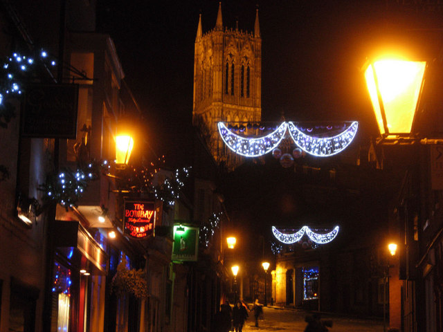
Image: © Stephen McKay Taken: 10 Dec 2010
The Strait is the first section of the ever-steepening hill that leads up from the Lincoln's High Street towards the cathedral and the castle; further up the narrow street is called 'Steep Hill'. At night, overshadowed by the illuminated cathedral and here decked with Christmas lights, this must be one of the most atmospheric cityscapes in Britain.
Images are licensed for reuse under creativecommons.org/licenses/by-sa/2.0
Image Location
Latitude
53.231766
Longitude
-0.539084