Vinery Road
Introduction
The photograph on this page of Vinery Road by John Sutton as part of the Geograph project.
The Geograph project started in 2005 with the aim of publishing, organising and preserving representative images for every square kilometre of Great Britain, Ireland and the Isle of Man.

There are currently over 7.5m images from over 14,400 individuals and you can help contribute to the project by visiting https://www.geograph.org.uk
Vinery Road
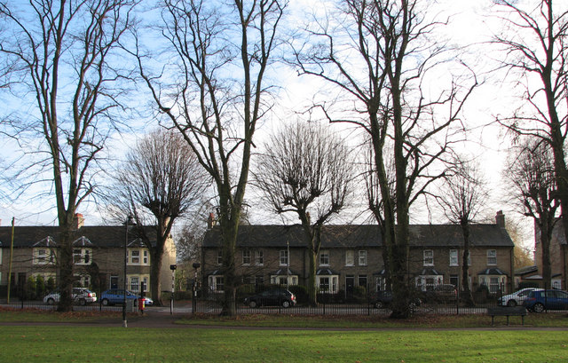
Image: © John Sutton Taken: 12 Dec 2010
Though they look Victorian or Edwardian, these terraced houses - seen from the park opposite - are some of Cambridge's first council houses, built in 1924. It's interesting, I think, that an off-the-peg design was chosen; later in the inter-wars years councils all over the country favoured variations of the familiar garden-city cottage style. The trees on the edge of the Rec must be some of the tallest on this side of town.
Images are licensed for reuse under creativecommons.org/licenses/by-sa/2.0
Image Location
Latitude
52.199947
Longitude
0.152738