Blizzard on A80 at Condorrat
Introduction
The photograph on this page of Blizzard on A80 at Condorrat by Robert Murray as part of the Geograph project.
The Geograph project started in 2005 with the aim of publishing, organising and preserving representative images for every square kilometre of Great Britain, Ireland and the Isle of Man.

There are currently over 7.5m images from over 14,400 individuals and you can help contribute to the project by visiting https://www.geograph.org.uk
Blizzard on A80 at Condorrat
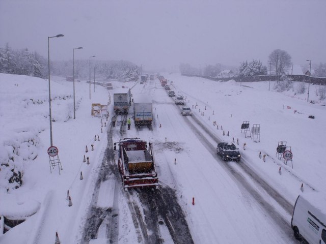
Image: © Robert Murray Taken: 6 Dec 2010
This is the morning of the day that Scotland's trunk routes, motorways and hundreds of other roads ground to a halt stranding drivers and passengers for up to 15 hours on impassable roads in temperatures that went to minus 17c overnight. This road [main route from Glasgow to the north] took three days to clear. submission No.2,000
Images are licensed for reuse under creativecommons.org/licenses/by-sa/2.0
Image Location
Latitude
55.937403
Longitude
-4.026851