Ashlyns Road, Berkhamsted in 1929
Introduction
The photograph on this page of Ashlyns Road, Berkhamsted in 1929 by George W Baker as part of the Geograph project.
The Geograph project started in 2005 with the aim of publishing, organising and preserving representative images for every square kilometre of Great Britain, Ireland and the Isle of Man.

There are currently over 7.5m images from over 14,400 individuals and you can help contribute to the project by visiting https://www.geograph.org.uk
Ashlyns Road, Berkhamsted in 1929
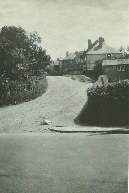
Image: © George W Baker Taken: Unknown
View taken from Upper Kings Road by my paternal grandfather George W Baker showing the road before it was made-up
Images are licensed for reuse under creativecommons.org/licenses/by-sa/2.0
Image Location
Latitude
51.756403
Longitude
-0.569848