Hurst Green: a view across gardens and rooftops
Introduction
The photograph on this page of Hurst Green: a view across gardens and rooftops by Stefan Czapski as part of the Geograph project.
The Geograph project started in 2005 with the aim of publishing, organising and preserving representative images for every square kilometre of Great Britain, Ireland and the Isle of Man.

There are currently over 7.5m images from over 14,400 individuals and you can help contribute to the project by visiting https://www.geograph.org.uk
Hurst Green: a view across gardens and rooftops
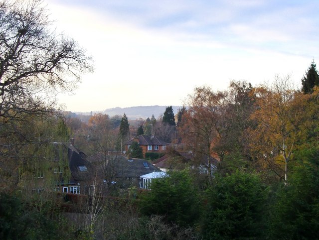
Image: © Stefan Czapski Taken: 28 Nov 2010
Seen from the raised station approach. The area must have been entirely rural when the London, Brighton & South Coast Railway reached here in 1884, as it extended its tentacles to Lingfield, Edenbridge and Hever. Even then, it was not until 23 years later - 1907 - that trains condescended to stop. (The station was originally known as 'Hurst Green Halt', making it sound like a request stop). It was only after the place had a station that residential development could go ahead. Hurst Green's permanent parish church was not built until 1912, replacing an earlier structure first provided for the navvies who constructed the railway. The view is WNW, on a chilly November afternoon. The tower of St John's Church is just visible between two tall cypress trees, just to the right of the centre of the frame. In the distance are the North Downs, beyond the M25. The history of the railways of these parts is told, in plodding fashion, in Dendy Marshall's book, 'A History of the Southern Railway'.
Images are licensed for reuse under creativecommons.org/licenses/by-sa/2.0
Image Location
Latitude
51.245134
Longitude
-0.000472