2010 : Broomhill Road, Brislington, Bristol
Introduction
The photograph on this page of 2010 : Broomhill Road, Brislington, Bristol by Maurice Pullin as part of the Geograph project.
The Geograph project started in 2005 with the aim of publishing, organising and preserving representative images for every square kilometre of Great Britain, Ireland and the Isle of Man.

There are currently over 7.5m images from over 14,400 individuals and you can help contribute to the project by visiting https://www.geograph.org.uk
2010 : Broomhill Road, Brislington, Bristol
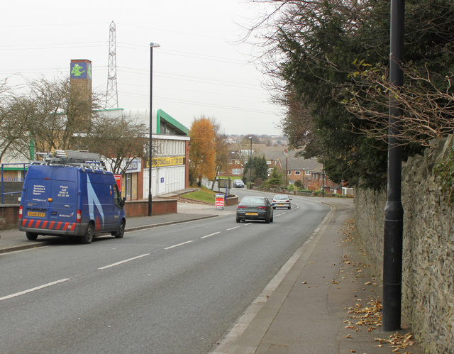
Image: © Maurice Pullin Taken: 26 Nov 2010
Looking north toward Broomhill and St.Anne's Park. The boundary wall of St.Brendan's R.C. College is on the right. Business premises to the left include Alligator Self Storage Co. Ltd. who also sell boxes (note the green alligator at the top of the chimney). The blue van belongs to a gas installation firm, possibly British Gas. The housing at the bottom of the hill looks like the 1960's or 70's style. The turning to the right at the end of the stone wall is Ironmould Lane.
Images are licensed for reuse under creativecommons.org/licenses/by-sa/2.0
Image Location
Latitude
51.433998
Longitude
-2.5325