Southend Airport and more
Introduction
The photograph on this page of Southend Airport and more by terry joyce as part of the Geograph project.
The Geograph project started in 2005 with the aim of publishing, organising and preserving representative images for every square kilometre of Great Britain, Ireland and the Isle of Man.

There are currently over 7.5m images from over 14,400 individuals and you can help contribute to the project by visiting https://www.geograph.org.uk
Southend Airport and more
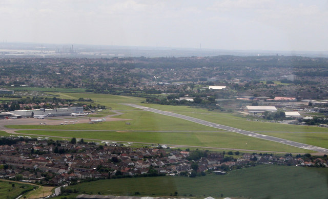
Image: © terry joyce Taken: 22 Jun 2008
The runway is in this grid, Image and a small section in Image When the runway is extended there will be more in the latter grid, extending across Eastwoodbury Lane and into the field. At the top left of the picture it is possible to see Image
Images are licensed for reuse under creativecommons.org/licenses/by-sa/2.0
Image Location
Latitude
51.572836
Longitude
0.703724