Private bridge, Ballysallagh Road near Bangor
Introduction
The photograph on this page of Private bridge, Ballysallagh Road near Bangor by Albert Bridge as part of the Geograph project.
The Geograph project started in 2005 with the aim of publishing, organising and preserving representative images for every square kilometre of Great Britain, Ireland and the Isle of Man.

There are currently over 7.5m images from over 14,400 individuals and you can help contribute to the project by visiting https://www.geograph.org.uk
Private bridge, Ballysallagh Road near Bangor
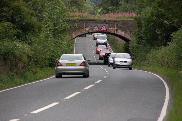
Image: © Albert Bridge Taken: 11 Aug 2006
The Ballysallagh Road runs from the Belfast Road to Craigantlet cross roads cutting through the Clandeboye estate in the process. This bridge is part of the estate and crosses the Ballysallagh Road just after it leaves the Belfast Road. This is the view towards Craigantlet. The bridge is not marked on the OS map. The Ballysallagh Road is part of the back road from Bangor to Belfast and Newtownards. For a later view see Image
Images are licensed for reuse under creativecommons.org/licenses/by-sa/2.0
Image Location


Leaflet Map data © OpenStreetMap
Latitude
54.642081
Longitude
-5.716023