Stop and Call, Goodwick
Introduction
The photograph on this page of Stop and Call, Goodwick by Natasha Ceridwen de Chroustchoff as part of the Geograph project.
The Geograph project started in 2005 with the aim of publishing, organising and preserving representative images for every square kilometre of Great Britain, Ireland and the Isle of Man.

There are currently over 7.5m images from over 14,400 individuals and you can help contribute to the project by visiting https://www.geograph.org.uk
Stop and Call, Goodwick
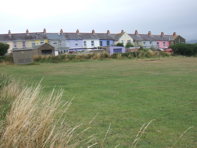
Image: © Natasha Ceridwen de Chroustchoff Taken: 9 Aug 2006
The backs of these colourful terraced houses, viewed across the rec, are part of the charmingly-named C20 community up above Goodwick. In Welsh it is called Stopio a Galw but there appears to be no clue as to the origin of the name.
Images are licensed for reuse under creativecommons.org/licenses/by-sa/2.0
Image Location
Latitude
52.004083
Longitude
-5.003069