
Denton Chare
Introduction
The photograph on this page of Denton Chare by Andrew Curtis as part of the Geograph project.
The Geograph project started in 2005 with the aim of publishing, organising and preserving representative images for every square kilometre of Great Britain, Ireland and the Isle of Man.

There are currently over 7.5m images from over 14,400 individuals and you can help contribute to the project by visiting https://www.geograph.org.uk
Denton Chare
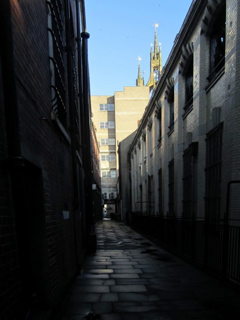
Image: © Andrew Curtis Taken: 24 Nov 2010
Denton Chare runs between Westgate Road and St Nicholas Street between the buildings on Collingwood Street on the left and the old Post Office and Stamp Exchange on the right. It is the route of an ancient narrow lane through the town where people lived and worked, but is now mainly just a service alley for the business premises on both side. The view is towards St Nicholas Street with the cathedral spire visible above the buildings. There is another photo here Image
Images are licensed for reuse under creativecommons.org/licenses/by-sa/2.0
Image Location

Latitude
54.969734
Longitude
-1.612737