Boundary stone, Scholes Lane, Scholes, Cleckheaton
Introduction
The photograph on this page of Boundary stone, Scholes Lane, Scholes, Cleckheaton by Humphrey Bolton as part of the Geograph project.
The Geograph project started in 2005 with the aim of publishing, organising and preserving representative images for every square kilometre of Great Britain, Ireland and the Isle of Man.

There are currently over 7.5m images from over 14,400 individuals and you can help contribute to the project by visiting https://www.geograph.org.uk
Boundary stone, Scholes Lane, Scholes, Cleckheaton
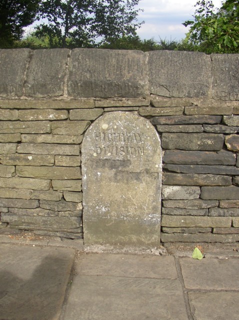
Image: © Humphrey Bolton Taken: 4 Aug 2006
Boundary stones were often erected to show where the responsibility for highway maintenance changed, and this one is inscribed 'HIGHWAY DIVISION' The place names have been defaced, presumably when part of Clifton was transferred to Spenborough UDC, but appear to be 'SCHOLES' on the left (as too short for 'Cleckheaton') and 'CLIFTON' on the right.
Images are licensed for reuse under creativecommons.org/licenses/by-sa/2.0
Image Location
Latitude
53.720245
Longitude
-1.74841