Southfields Library
Introduction
The photograph on this page of Southfields Library by Derek Harper as part of the Geograph project.
The Geograph project started in 2005 with the aim of publishing, organising and preserving representative images for every square kilometre of Great Britain, Ireland and the Isle of Man.

There are currently over 7.5m images from over 14,400 individuals and you can help contribute to the project by visiting https://www.geograph.org.uk
Southfields Library
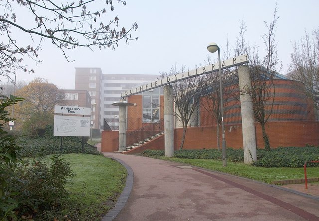
Image: © Derek Harper Taken: 16 Nov 2010
Prefaced by a row of three columns; seen from Wimbledon Park Road. The block of flats behind is Fernwood, one of six blocks between Wimbledon Park Road and Albert Drive.
Images are licensed for reuse under creativecommons.org/licenses/by-sa/2.0
Image Location
Latitude
51.443375
Longitude
-0.208539