Old manhole cover in Penn, Wolverhampton
Introduction
The photograph on this page of Old manhole cover in Penn, Wolverhampton by Roger D Kidd as part of the Geograph project.
The Geograph project started in 2005 with the aim of publishing, organising and preserving representative images for every square kilometre of Great Britain, Ireland and the Isle of Man.

There are currently over 7.5m images from over 14,400 individuals and you can help contribute to the project by visiting https://www.geograph.org.uk
Old manhole cover in Penn, Wolverhampton
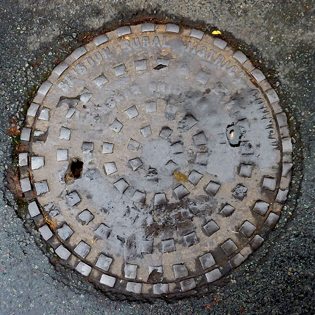
Image: © Roger D Kidd Taken: 14 Nov 2010
This very well worn drain cover near the top of Manor Road, Penn bears the wording SEISDON RURAL DISTRICT COUNCIL which seemed strange to me, as Seisdon is a small village in South Staffordshire four miles away (6.5 kilometres). This website http://www.archives.staffordshire.gov.uk/DServe/dserve.exe?dsqIni=DServeY.ini&dsqApp=Archive2&dsqCmd=Show.tcl&dsqDb=Catalog&dsqPos=0&dsqSearch=%28%28MgtSubGroup%3D%27District%20Councils%27%29AND%28Title%3D%27seisdon%20rural%20district%27%29%29 gives the following information: "Seisdon Rural District Council was created in 1894 with the Local Government Act 1894 ... Its areas of jurisdiction (reached as far as) Upper Penn (1894 - 1966) ... Seisdon Rural District was abolished in 1974 with the Local Government Act of 1974, when it was merged with Cannock Rural District to form South Staffordshire District Council." Upper Penn, however, had previously been transferred from Staffordshire to Wolverhampton (West Midlands) Council in 1966.
Images are licensed for reuse under creativecommons.org/licenses/by-sa/2.0
Image Location
Latitude
52.559529
Longitude
-2.147833