Manchester, Bolton & Bury Canal; Site of Breach
Introduction
The photograph on this page of Manchester, Bolton & Bury Canal; Site of Breach by David Dixon as part of the Geograph project.
The Geograph project started in 2005 with the aim of publishing, organising and preserving representative images for every square kilometre of Great Britain, Ireland and the Isle of Man.

There are currently over 7.5m images from over 14,400 individuals and you can help contribute to the project by visiting https://www.geograph.org.uk
Manchester, Bolton & Bury Canal; Site of Breach
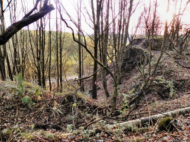
Image: © David Dixon Taken: 14 Nov 2010
The site of the breach, a short way east of the Nob End locks. Looking west from the canal bed, into the breach, which occurred on 6th July 1936, draining the canal of all its water. Railway lines that had been used to reinforce the steep embankment can still be seen sticking out from the remains. (http://www.boltonmuseums.org.uk/collections/local-history/archivesimages02/1940loc?term=photograph&s_tags=&sort_by=Title&item_number=393&b_start:int=0 and http://www.boltonmuseums.org.uk/collections/local-history/archivesimages02/1941loc?term=photograph&s_tags=&sort_by=Title&item_number=394&b_start:int=0 contemporary photographs in Bolton Museum archives http://www.penninewaterways.co.uk/mbb/mbbc30.htm another contemporary photograph from the John and Margaret Fletcher Collection)
Images are licensed for reuse under creativecommons.org/licenses/by-sa/2.0
Image Location
Latitude
53.555104
Longitude
-2.371911