Linton Park
Introduction
The photograph on this page of Linton Park by David Kemp as part of the Geograph project.
The Geograph project started in 2005 with the aim of publishing, organising and preserving representative images for every square kilometre of Great Britain, Ireland and the Isle of Man.

There are currently over 7.5m images from over 14,400 individuals and you can help contribute to the project by visiting https://www.geograph.org.uk
Linton Park
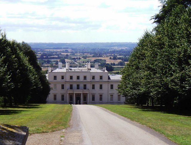
Image: © David Kemp Taken: 8 Aug 2006
This is the north side of Linton Park with the Low Weald in the background. The south side of the house is shown in the other Geograph. Built in the 1730s, Linton was described at the time as being "like a citadel in Kent, the whole county its garden". It was formerly the home of Lord Cornwallis.
Images are licensed for reuse under creativecommons.org/licenses/by-sa/2.0
Image Location
Latitude
51.221227
Longitude
0.516066