Flush bracket G2772 on St. Seiriol's Church, Penmaenmawr
Introduction
The photograph on this page of Flush bracket G2772 on St. Seiriol's Church, Penmaenmawr by Meirion as part of the Geograph project.
The Geograph project started in 2005 with the aim of publishing, organising and preserving representative images for every square kilometre of Great Britain, Ireland and the Isle of Man.

There are currently over 7.5m images from over 14,400 individuals and you can help contribute to the project by visiting https://www.geograph.org.uk
Flush bracket G2772 on St. Seiriol's Church, Penmaenmawr
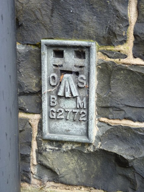
Image: © Meirion Taken: 8 Nov 2010
This flush bracket located on the SE face of St. Seiriol's Church in Penmaenmawr is shown in the Ordnance Survey database as being 46.2037m above the Newlyn datum. See also: Image
Images are licensed for reuse under creativecommons.org/licenses/by-sa/2.0
Image Location
Latitude
53.270128
Longitude
-3.918112