Up freight approaching Stapleford & Sandiacre Station
Introduction
The photograph on this page of Up freight approaching Stapleford & Sandiacre Station by Ben Brooksbank as part of the Geograph project.
The Geograph project started in 2005 with the aim of publishing, organising and preserving representative images for every square kilometre of Great Britain, Ireland and the Isle of Man.

There are currently over 7.5m images from over 14,400 individuals and you can help contribute to the project by visiting https://www.geograph.org.uk
Up freight approaching Stapleford & Sandiacre Station
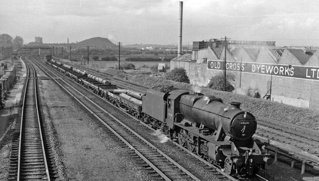
Image: © Ben Brooksbank Taken: 17 May 1962
View NW from A52 bridge towards Chesterfield, on the Erewash Valley main line, the ex-Midland north-south trunk route. The colliery waste tip in the distance was at Stanton Gate.
Images are licensed for reuse under creativecommons.org/licenses/by-sa/2.0
Image Location
Latitude
52.923479
Longitude
-1.283022