Brigstock Road: looking downstream at the crossing of Norbury Brook
Introduction
The photograph on this page of Brigstock Road: looking downstream at the crossing of Norbury Brook by Christopher Hilton as part of the Geograph project.
The Geograph project started in 2005 with the aim of publishing, organising and preserving representative images for every square kilometre of Great Britain, Ireland and the Isle of Man.

There are currently over 7.5m images from over 14,400 individuals and you can help contribute to the project by visiting https://www.geograph.org.uk
Brigstock Road: looking downstream at the crossing of Norbury Brook
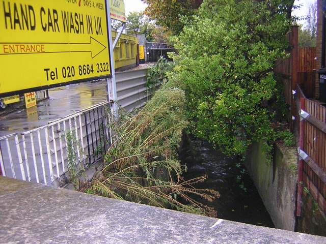
Image: © Christopher Hilton Taken: 8 Nov 2010
The Norbury Brook is a tributary of the Thames that slides mostly unnoticed through suburbia, along the backs of gardens. This is taken from Brigstock Road looking downstream. It was a day of heavy rain and autumnal gales, and the water level in the brook had risen noticeably: despite its invisibility, it still does what a natural watercourse does in these circumstances, whether people are watching or not. See also Image for the view in the other direction at this point, and Image for the next crossing downstream at Quadrant Road.
Images are licensed for reuse under creativecommons.org/licenses/by-sa/2.0
Image Location
Latitude
51.397652
Longitude
-0.103084