Muswell Hill
Introduction
The photograph on this page of Muswell Hill by Martin Addison as part of the Geograph project.
The Geograph project started in 2005 with the aim of publishing, organising and preserving representative images for every square kilometre of Great Britain, Ireland and the Isle of Man.

There are currently over 7.5m images from over 14,400 individuals and you can help contribute to the project by visiting https://www.geograph.org.uk
Muswell Hill
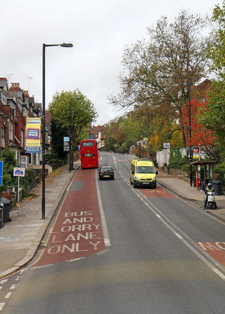
Image: © Martin Addison Taken: 28 Oct 2010
Halfway up the long grind from Park Road at the bottom to Muswell Hill Broadway at the top. The lane at the side has unusually been marked up as both a bus lane and a crawler lane for lorries, which emphasises the steepness of the climb. This view was taken from the top deck of a W7 bus which runs between Muswell Hill Broadway and Finsbury Park Station.
Images are licensed for reuse under creativecommons.org/licenses/by-sa/2.0
Image Location
Latitude
51.589658
Longitude
-0.137683