Shute House, Sandford
Introduction
The photograph on this page of Shute House, Sandford by Derek Harper as part of the Geograph project.
The Geograph project started in 2005 with the aim of publishing, organising and preserving representative images for every square kilometre of Great Britain, Ireland and the Isle of Man.

There are currently over 7.5m images from over 14,400 individuals and you can help contribute to the project by visiting https://www.geograph.org.uk
Shute House, Sandford
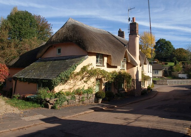
Image: © Derek Harper Taken: 25 Oct 2010
The thatched cottage was originally C16 http://www.britishlistedbuildings.co.uk/en-446863-129-sandford . In the background is the railed off stream shown in Image
Images are licensed for reuse under creativecommons.org/licenses/by-sa/2.0
Image Location
Latitude
50.810403
Longitude
-3.66668