Reservoir
Introduction
The photograph on this page of Reservoir by Sharon Loxton as part of the Geograph project.
The Geograph project started in 2005 with the aim of publishing, organising and preserving representative images for every square kilometre of Great Britain, Ireland and the Isle of Man.

There are currently over 7.5m images from over 14,400 individuals and you can help contribute to the project by visiting https://www.geograph.org.uk
Reservoir
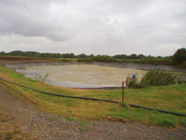
Image: © Sharon Loxton Taken: 1 Aug 2006
On the OS map this plastic lined area of water is marked as a reservoir. It was not what I had anticipated. The little water remaining in the plastic lined rectangle was sludgy and looked distinctly non-potable.
Images are licensed for reuse under creativecommons.org/licenses/by-sa/2.0
Image Location


Leaflet Map data © OpenStreetMap
Latitude
51.402522
Longitude
-2.718731