Roches Moutonn?es
Introduction
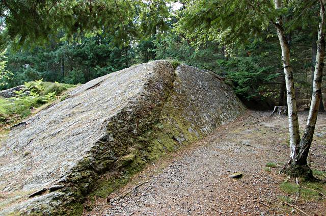
The photograph on this page of Roches Moutonn?es by Jim Bain as part of the Geograph project.
The Geograph project started in 2005 with the aim of publishing, organising and preserving representative images for every square kilometre of Great Britain, Ireland and the Isle of Man.
There are currently over 7.5m images from over 14,400 individuals and you can help contribute to the project by visiting https://www.geograph.org.uk

Image: © Jim Bain Taken: 30 Jul 2006
Leading edge to the left trailing to the right. These distinctive glacial features are formed when the moving ice sheet passes over exposed lumpy bedrock. The ice is forced up the rock and smooths and scores as it goes, giving a gently sloping profile on the leading edge. However at the rear of the rock there is little support for the bedrock and it tends to get plucked off bit by bit leaving a sharp edge and a steeper face. From above the roches look like an arrow head in plan and they point into the direction in which the ice sheet passed over them. In this area it is estimated that the ice sheet was up to around 700mts thick.

