Bermondsey Wall West
Introduction
The photograph on this page of Bermondsey Wall West by Martin Addison as part of the Geograph project.
The Geograph project started in 2005 with the aim of publishing, organising and preserving representative images for every square kilometre of Great Britain, Ireland and the Isle of Man.

There are currently over 7.5m images from over 14,400 individuals and you can help contribute to the project by visiting https://www.geograph.org.uk
Bermondsey Wall West
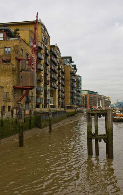
Image: © Martin Addison Taken: 22 Oct 2010
A view of the riverside of the converted wharves. A solitary crane reminds us of the once busy scenes here where tea, coffee and spices were amongst the goods unloaded for a rapidly growing London. Congestion on the river, larger ships and finally containerisation all played a role in moving the traffic downstream to Tilbury and beyond.
Images are licensed for reuse under creativecommons.org/licenses/by-sa/2.0
Image Location
Latitude
51.501492
Longitude
-0.06797