Shad Thames
Introduction
The photograph on this page of Shad Thames by Martin Addison as part of the Geograph project.
The Geograph project started in 2005 with the aim of publishing, organising and preserving representative images for every square kilometre of Great Britain, Ireland and the Isle of Man.

There are currently over 7.5m images from over 14,400 individuals and you can help contribute to the project by visiting https://www.geograph.org.uk
Shad Thames
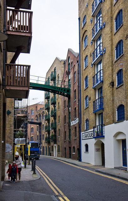
Image: © Martin Addison Taken: 22 Oct 2010
Looking northeast from the junction with Queen Elizabeth Street. On the right are St. Saviours and St. Andrews Wharves, both now converted to offices and apartments. St. Saviours Wharf takes its name from the dock behind the line of wharves. The Wharves originally housed imported tea, coffee and spices.
Images are licensed for reuse under creativecommons.org/licenses/by-sa/2.0
Image Location
Latitude
51.501473
Longitude
-0.072841