Buckingham: The Ford
Introduction
The photograph on this page of Buckingham: The Ford by Nigel Cox as part of the Geograph project.
The Geograph project started in 2005 with the aim of publishing, organising and preserving representative images for every square kilometre of Great Britain, Ireland and the Isle of Man.

There are currently over 7.5m images from over 14,400 individuals and you can help contribute to the project by visiting https://www.geograph.org.uk
Buckingham: The Ford
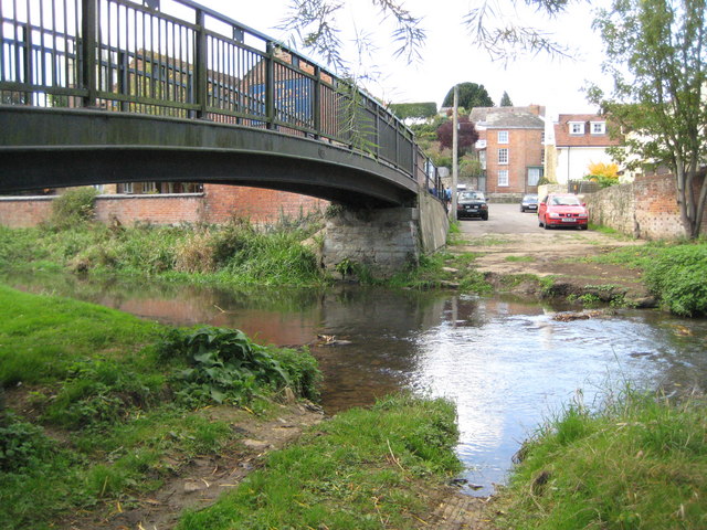
Image: © Nigel Cox Taken: 17 Oct 2010
Once upon a time this ford over the River Great Ouse was the main route into the centre of the town from the south, and the whole thoroughfare up to Well Street in the distance was known as Ford Street. By 1805 the main London Bridge had been built further downstream, to the east and to the right, and the ford lost its importance. Today the pedestrian Woolpack Bridge on the left has replaced an earlier structure, and the road on the far side has been renamed as an extension of Elm Street, coming down across and from the far side of Well Street. Nonetheless the tyre tracks in the mud indicate that some use of it is still made by motor traffic today. The Buckingham Town Council Winter 2010 newsletter has some news on the ford here http://www.buckingham-tc.gov.uk/newsitems/newsletter_storage/2010-01-newsletter_web.pdf
Images are licensed for reuse under creativecommons.org/licenses/by-sa/2.0
Image Location
Latitude
51.998018
Longitude
-0.987205