Junction Road
Introduction
The photograph on this page of Junction Road by Simon Carey as part of the Geograph project.
The Geograph project started in 2005 with the aim of publishing, organising and preserving representative images for every square kilometre of Great Britain, Ireland and the Isle of Man.

There are currently over 7.5m images from over 14,400 individuals and you can help contribute to the project by visiting https://www.geograph.org.uk
Junction Road
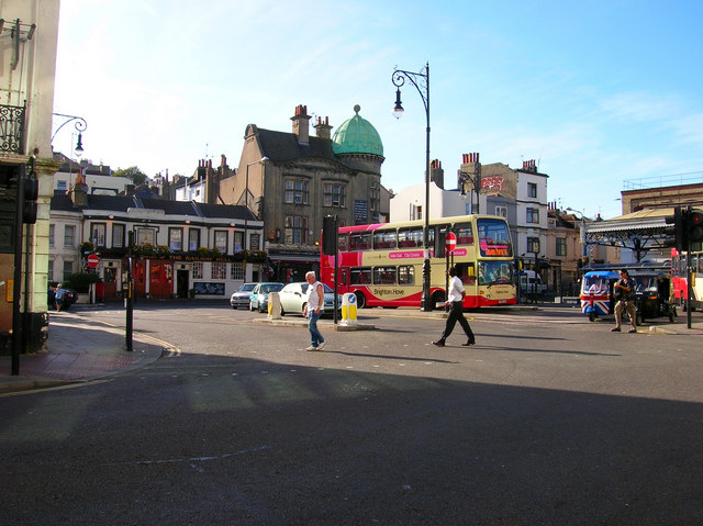
Image: © Simon Carey Taken: 30 Jul 2006
Head north along Surrey Street until you reach the Railway Belle pub then turn east. The buildings on the western side originally continued up to the entrance of the station but was causing traffic problems by the 1920s when it was decided to link Queens Road to Surrey Street. The victim was the Terminus Hotel which was demolished to make way for it. Consequently, Junction Road is the length of two buses. The two pubs next to each other are the Railway Belle to the left and Grand Central to the right. The latter originally opened as the Railway Hotel in the 1860s the upstairs of which was converted into a 50 seat theatre in the 1970s called the Nightingale. The theatre closed for 7 years as the pub below changed hands but it has recently reopened again. To the right of the bus with the union jack frontage is a tuctuc, ubiquitous in the Asian subcontinent, and introduced to Brighton streets in June 2006 where they have become enormously popular. At present they only served Hove and the Marina and are cheaper than both bus and taxi. Not surprisingly they are not very popular with the latter. How they cope with the south westerly gales during the autumn will be interesting to see. Click on the link to take you to the next page. http://www.geograph.org.uk/photo/212557
Images are licensed for reuse under creativecommons.org/licenses/by-sa/2.0
Image Location
Latitude
50.827947
Longitude
-0.142742