Buckingham: Former railway line now a pond
Introduction
The photograph on this page of Buckingham: Former railway line now a pond by Nigel Cox as part of the Geograph project.
The Geograph project started in 2005 with the aim of publishing, organising and preserving representative images for every square kilometre of Great Britain, Ireland and the Isle of Man.

There are currently over 7.5m images from over 14,400 individuals and you can help contribute to the project by visiting https://www.geograph.org.uk
Buckingham: Former railway line now a pond
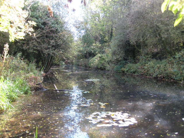
Image: © Nigel Cox Taken: 17 Oct 2010
46 years after closure of the railway and the trackbed of the former Banbury to Verney Junction Branch line, just south-east of the location of the long-demolished Buckingham station, has, either by nature or design, filled up with water in a shallow cutting. The feature is now even shown as a pond on the Ordnance Survey 1:25,000 scale mapping, and is visible alongside Buckingham's Railway Walk.
Images are licensed for reuse under creativecommons.org/licenses/by-sa/2.0
Image Location
Latitude
51.992634
Longitude
-0.988492