Crossroads near Ettingshall, Wolverhampton
Introduction
The photograph on this page of Crossroads near Ettingshall, Wolverhampton by Roger D Kidd as part of the Geograph project.
The Geograph project started in 2005 with the aim of publishing, organising and preserving representative images for every square kilometre of Great Britain, Ireland and the Isle of Man.

There are currently over 7.5m images from over 14,400 individuals and you can help contribute to the project by visiting https://www.geograph.org.uk
Crossroads near Ettingshall, Wolverhampton
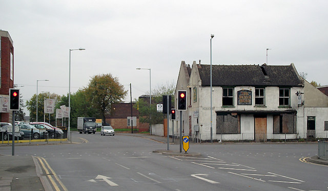
Image: © Roger D Kidd Taken: 15 Oct 2010
Straight ahead to Wolverhampton is Ettingshall Road. Left is Parkfield Road towards Penn, and to the right is Millfield Road to Bilston. Behind the camera is Manor Road, which transforms to Spring Road and leads to Coseley. The main purpose in taking this picture was to show that nothing much has happened to the Bull's Head pub on the corner in the last four years. Image Image
Images are licensed for reuse under creativecommons.org/licenses/by-sa/2.0
Image Location
Latitude
52.566033
Longitude
-2.101575