Railway line at Balderton Crossing
Introduction
The photograph on this page of Railway line at Balderton Crossing by John S Turner as part of the Geograph project.
The Geograph project started in 2005 with the aim of publishing, organising and preserving representative images for every square kilometre of Great Britain, Ireland and the Isle of Man.

There are currently over 7.5m images from over 14,400 individuals and you can help contribute to the project by visiting https://www.geograph.org.uk
Railway line at Balderton Crossing
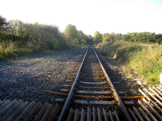
Image: © John S Turner Taken: 21 Oct 2010
Looking south, in the direction of Shrewsbury, from Balderton Crossing. The width of the track bed indicates that this was once a double track main line, as can be seen in Image; there was also a station on the other side of the lane. On the right of the photo there used to be a signal box. The stone bridge in the distance carries Balderton Drive that once was an approach road to Eaton Hall for the Duke of Westminster. The A55 has now severed that link.
Images are licensed for reuse under creativecommons.org/licenses/by-sa/2.0
Image Location
Latitude
53.153612
Longitude
-2.935762