
Brighton & Hove High School for Girls
Introduction
The photograph on this page of Brighton & Hove High School for Girls by Simon Carey as part of the Geograph project.
The Geograph project started in 2005 with the aim of publishing, organising and preserving representative images for every square kilometre of Great Britain, Ireland and the Isle of Man.

There are currently over 7.5m images from over 14,400 individuals and you can help contribute to the project by visiting https://www.geograph.org.uk
Brighton & Hove High School for Girls
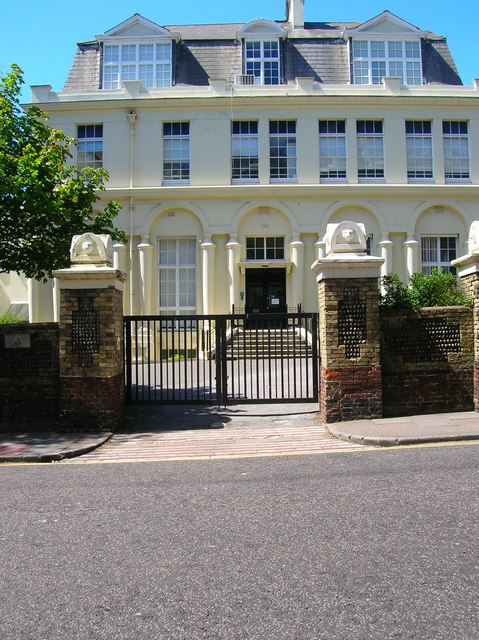
Image: © Simon Carey Taken: 30 Jul 2006
Continue south down Windlesham Road then turn east in Temple Gardens until you get to Montpelier Road (B2122). To the north is the entrance to the school. It was built in 1819 and known as The Temple or Kemp's Folly. A villa built by Amon and Amon Henry Wilds in then open countryside with a domed roof and the house built to the exact measurements of the Temple of Solomon for Thomas Kemp, local MP and builder of Kemp Town, where he moved to once that was completed. Kemp's fortunes took a turn for the worse in the 1830s being declared bankrupt and running off to the continent before his jailers and creditors could catch him. The Temple fell into disuse until the 1880s when Brighton & Hove High School moved into the premises. The building was extended in 1891 and radically changed in 1911-12 when the dome was removed. Click on the link to take you to the next page. http://www.geograph.org.uk/photo/211818
Images are licensed for reuse under creativecommons.org/licenses/by-sa/2.0
Image Location

Latitude
50.827206
Longitude
-0.152711