Stansfield All Saints church
Introduction
The photograph on this page of Stansfield All Saints church by Adrian S Pye as part of the Geograph project.
The Geograph project started in 2005 with the aim of publishing, organising and preserving representative images for every square kilometre of Great Britain, Ireland and the Isle of Man.

There are currently over 7.5m images from over 14,400 individuals and you can help contribute to the project by visiting https://www.geograph.org.uk
Stansfield All Saints church
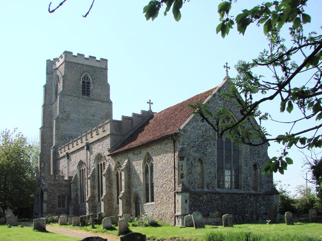
Image: © Adrian S Pye Taken: 8 May 2008
Stansfield church is perched on the brow of a hill heading down into the village below. It is quite an impressive church for a small parish and has a scratch dial on a buttress. It doesn’t have a clerestory and the windows of the embattled south aisle are not large enough to allow enough light into the 14th century nave. This unfortunately makes it quite a dark church, especially on a dull day. The font is of two distinct parts; the roughly carved bowl is 16th century. The four clusters of three columns which support it look like new. Between the chancel and the chapel is a 13th century arcade of two arches. Nearby is a coeval pillared squint. In the chancel there is an iron-bound chest, above which is the piscina. A Stuart goblet-style pulpit with steps leading up to it, stands on a stumpy pillar.
Images are licensed for reuse under creativecommons.org/licenses/by-sa/2.0
Image Location


Leaflet Map data © OpenStreetMap
Latitude
52.142
Longitude
0.604776