Workington North Temporary Station
Introduction
The photograph on this page of Workington North Temporary Station by Rose and Trev Clough as part of the Geograph project.
The Geograph project started in 2005 with the aim of publishing, organising and preserving representative images for every square kilometre of Great Britain, Ireland and the Isle of Man.

There are currently over 7.5m images from over 14,400 individuals and you can help contribute to the project by visiting https://www.geograph.org.uk
Workington North Temporary Station
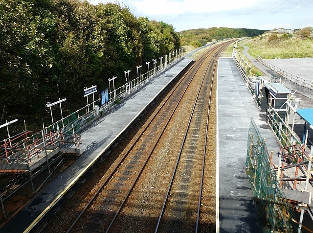
Image: © Rose and Trev Clough Taken: 30 Sep 2010
This station was built to help people get across the River Derwent, after flood damage put all the road and pedestrian bridges between the north and south sides of Workington out of use. The nearest station north of here is Flimby, about 4.4km along the track. Workington Station is about 1.5km south. Workington North was constructed by Network Rail in just 6 days, opening on 30 November 2009. The normal timetable was supplemented with hourly free shuttle trains between Workington and Maryport, financed by the Government. Cumbria County Council funded a bus service between the new station and the residential areas of Northside and Seaton. These arrangements ceased in May 2010, after a temporary road bridge was opened and passenger numbers declined. The temporary station closed on 8th October 2010, and will be dismantled - see Image .
Images are licensed for reuse under creativecommons.org/licenses/by-sa/2.0
Image Location
Latitude
54.658671
Longitude
-3.556633