East Acton: East Acton Lane
Introduction
The photograph on this page of East Acton: East Acton Lane by Nigel Cox as part of the Geograph project.
The Geograph project started in 2005 with the aim of publishing, organising and preserving representative images for every square kilometre of Great Britain, Ireland and the Isle of Man.

There are currently over 7.5m images from over 14,400 individuals and you can help contribute to the project by visiting https://www.geograph.org.uk
East Acton: East Acton Lane
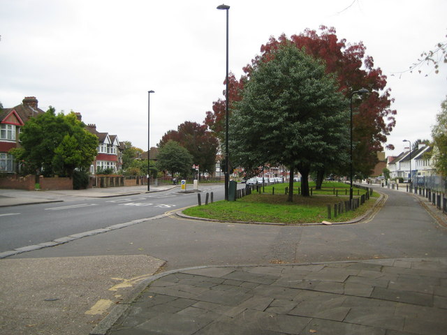
Image: © Nigel Cox Taken: 13 Oct 2010
The island of grass between the main East Acton Lane to the left and the access road to the right is a remnant of the time when East Acton was a separate village with a village green running through its entire length. This village green seems to have been developed in the 1850s and 1860s, as the 1850 Ordnance Survey map does not show it but the 1871 edition does. It extended from here at its western end right along to the surviving terrace of old houses south of Savoy Circus in what was then called Orchard Place.
Images are licensed for reuse under creativecommons.org/licenses/by-sa/2.0
Image Location
Latitude
51.512137
Longitude
-0.254266