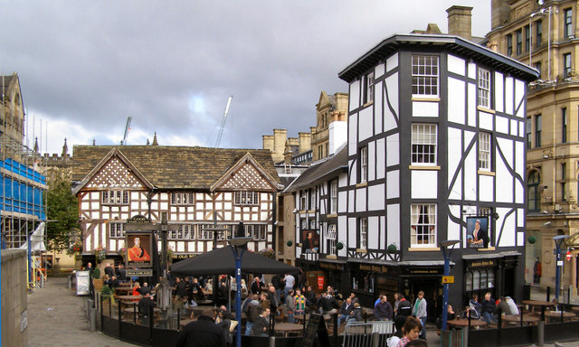
Shambles Square, Old Wellington Inn & Sinclair's Oyster Bar
Introduction
The photograph on this page of Shambles Square, Old Wellington Inn & Sinclair's Oyster Bar by David Dixon as part of the Geograph project.
The Geograph project started in 2005 with the aim of publishing, organising and preserving representative images for every square kilometre of Great Britain, Ireland and the Isle of Man.
There are currently over 7.5m images from over 14,400 individuals and you can help contribute to the project by visiting https://www.geograph.org.uk

Image: © David Dixon Taken: 16 Oct 2010
In 1974, when most of the old property between Shudehill and Market Street was demolished to accommodate Manchester’s new Arndale Shopping Centre, The Old Wellington Inn and Sinclair’s Oyster Bar were preserved (see Image], for a view taken in 1977). When the area was re-developed after the 1996 IRA bomb, it was decided that the buildings should be dismantled and moved 300 metres northwards to their present location, close to Manchester Cathedral. In 1999, the Old Wellington Inn and Sinclair's were rebuilt at 90 degrees to each other and joined together by a stone extension to form two sides of the new Shambles Square. The Wellington Inn is the only surviving Tudor building in Manchester City Centre. Both it and Sinclair’s Oyster Bar were designated as Grade II listed buildings in 1952. http://en.wikipedia.org/wiki/Shambles_Square,_Manchester for more information.

