The Fosse Way from the air
Introduction
The photograph on this page of The Fosse Way from the air by Thomas Nugent as part of the Geograph project.
The Geograph project started in 2005 with the aim of publishing, organising and preserving representative images for every square kilometre of Great Britain, Ireland and the Isle of Man.

There are currently over 7.5m images from over 14,400 individuals and you can help contribute to the project by visiting https://www.geograph.org.uk
The Fosse Way from the air
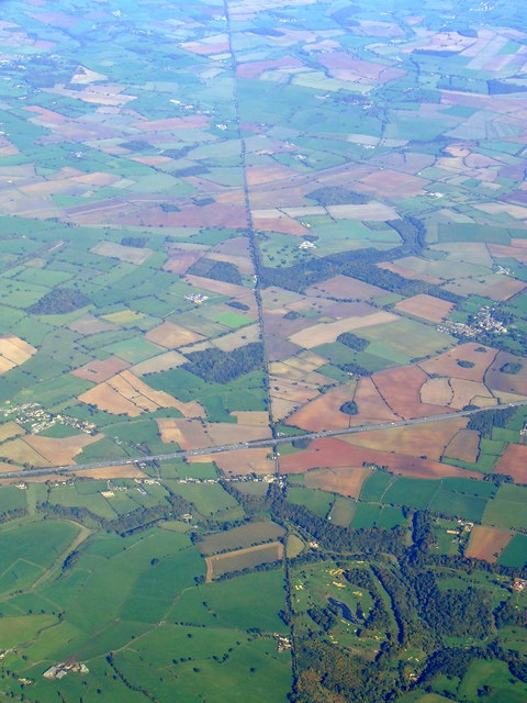
Image: © Thomas Nugent Taken: 11 Oct 2010
Crossed by the M4 Motorway near Littleton Drew. Manor House Golf Club is in the lower right of the photo which was taken from a Prague bound flight from Bristol. This http://en.wikipedia.org/wiki/Fosse_Way provides information about The Fosse Way.
Images are licensed for reuse under creativecommons.org/licenses/by-sa/2.0
Image Location
Latitude
51.505188
Longitude
-2.239121