Beach huts near Herne Bay
Introduction
The photograph on this page of Beach huts near Herne Bay by Marathon as part of the Geograph project.
The Geograph project started in 2005 with the aim of publishing, organising and preserving representative images for every square kilometre of Great Britain, Ireland and the Isle of Man.

There are currently over 7.5m images from over 14,400 individuals and you can help contribute to the project by visiting https://www.geograph.org.uk
Beach huts near Herne Bay
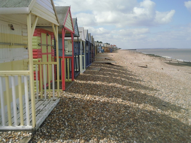
Image: © Marathon Taken: 17 Sep 2010
This fine row of colourful beach huts can be seen between Herne Bay and Hampton. Hampton Pier can be seen in the distance on the right. The Isle of Sheppey can clearly be seen beyond.
Images are licensed for reuse under creativecommons.org/licenses/by-sa/2.0
Image Location
Latitude
51.372133
Longitude
1.111484