Earthquake House, Comrie
Introduction
The photograph on this page of Earthquake House, Comrie by Jim Barton as part of the Geograph project.
The Geograph project started in 2005 with the aim of publishing, organising and preserving representative images for every square kilometre of Great Britain, Ireland and the Isle of Man.

There are currently over 7.5m images from over 14,400 individuals and you can help contribute to the project by visiting https://www.geograph.org.uk
Earthquake House, Comrie
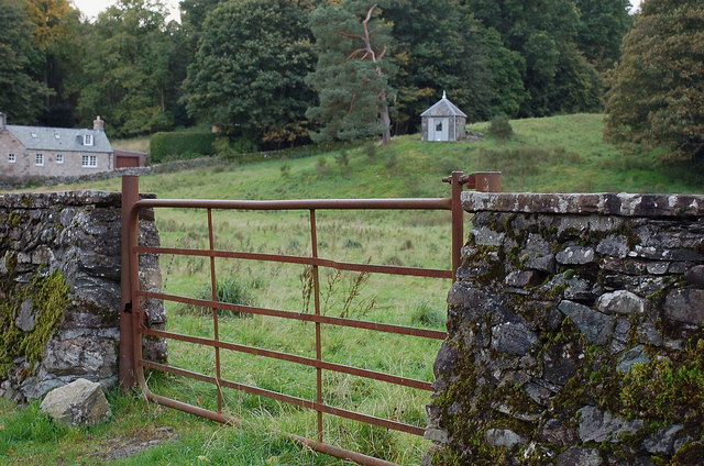
Image: © Jim Barton Taken: 7 Oct 2010
The small building resembling a summerhouse in the field was a pioneering scientific venture to measure earthquake tremors, built in 1874. Tremors had been felt in the area in the 1840s, leading to an initiative by the British Association for the Advancement of Science to test a number of instruments in and near Comrie capable of responding to earthquake movements. The building housed a 'seismoscope' consisting of several wooden cylinders of different diameters standing upright - a tremor would shake the cylinders sideways and topple them. The stronger the tremor, the larger would be the diameters that were knocked over. (Source - leaflet available at the Earthquake House) More on UK earthquakes is available at http://www.earthquakes.bgs.ac.uk/
Images are licensed for reuse under creativecommons.org/licenses/by-sa/2.0
Image Location
Latitude
56.372243
Longitude
-4.000496