Barker Crossing, River Derwent, Workington
Introduction
The photograph on this page of Barker Crossing, River Derwent, Workington by Rose and Trev Clough as part of the Geograph project.
The Geograph project started in 2005 with the aim of publishing, organising and preserving representative images for every square kilometre of Great Britain, Ireland and the Isle of Man.

There are currently over 7.5m images from over 14,400 individuals and you can help contribute to the project by visiting https://www.geograph.org.uk
Barker Crossing, River Derwent, Workington
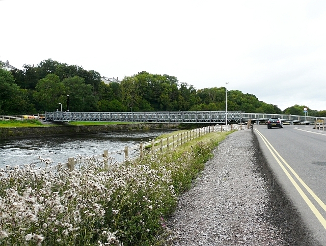
Image: © Rose and Trev Clough Taken: 28 Aug 2010
In November 2009 severe flooding of the River Derwent brought down or damaged all four road and pedestrian bridges in Workington. The railway bridge survived, but travelling between the north and south sides of the town by road involved a 14 mile detour, with long delays in the rush hour. The Army were requested to build this temporary footbridge, and worked round the clock in difficult conditions to complete it. The bridge was opened 18 days after the floods hit. It is named in memory of Police Constable Bill Barker, who was swept to his death when the Northside Bridge http://www.geograph.org.uk/photo/571476 collapsed under him as he was directing motorists away from it. For more information see Wikipedia article http://en.wikipedia.org/wiki/Barker_Crossing . Other photos with additional descriptions on Geograph : http://www.geograph.org.uk/photo/2096743 http://www.geograph.org.uk/photo/2096817 http://www.geograph.org.uk/photo/2096835 .
Images are licensed for reuse under creativecommons.org/licenses/by-sa/2.0
Image Location
Latitude
54.648602
Longitude
-3.535789