Model Village, Nenthead.
Introduction
The photograph on this page of Model Village, Nenthead. by Les Hull as part of the Geograph project.
The Geograph project started in 2005 with the aim of publishing, organising and preserving representative images for every square kilometre of Great Britain, Ireland and the Isle of Man.

There are currently over 7.5m images from over 14,400 individuals and you can help contribute to the project by visiting https://www.geograph.org.uk
Model Village, Nenthead.
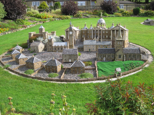
Image: © Les Hull Taken: 22 Sep 2010
This one of several clusters of model buildings built to a very high specification in a garden on the edge of Nenthead.
Images are licensed for reuse under creativecommons.org/licenses/by-sa/2.0
Image Location


Leaflet Map data © OpenStreetMap
Latitude
54.790672
Longitude
-2.344743