Glasgow: walkway from SECC to the station
Introduction
The photograph on this page of Glasgow: walkway from SECC to the station by Chris Downer as part of the Geograph project.
The Geograph project started in 2005 with the aim of publishing, organising and preserving representative images for every square kilometre of Great Britain, Ireland and the Isle of Man.

There are currently over 7.5m images from over 14,400 individuals and you can help contribute to the project by visiting https://www.geograph.org.uk
Glasgow: walkway from SECC to the station
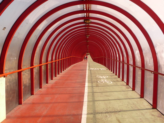
Image: © Chris Downer Taken: 26 Sep 2010
This covered walkway runs from Image over the main A814 dual carriageway and then takes a 90-degree turn and proceeds along this much longer straight to Exhibition Centre station. Because of the width required for the main road on the map, it is drawn as if the section crossing the road is by far the longer. See Image for a view from the same corner, along the other segment.
Images are licensed for reuse under creativecommons.org/licenses/by-sa/2.0
Image Location
Latitude
55.861796
Longitude
-4.284834