Great Livermere Church
Introduction
The photograph on this page of Great Livermere Church by Stephen McKay as part of the Geograph project.
The Geograph project started in 2005 with the aim of publishing, organising and preserving representative images for every square kilometre of Great Britain, Ireland and the Isle of Man.

There are currently over 7.5m images from over 14,400 individuals and you can help contribute to the project by visiting https://www.geograph.org.uk
Great Livermere Church
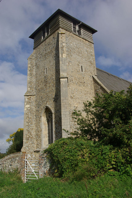
Image: © Stephen McKay Taken: 25 Sep 2010
The tower of St Peter's Church dates from the 12th century, although the wooden section at the top - which gives the building its unusual appearance - is modern. The original upper stage collapsed in a storm in 1871 - apparently on the eve of the churchwarden's daughter's wedding.
Images are licensed for reuse under creativecommons.org/licenses/by-sa/2.0
Image Location
Latitude
52.30844
Longitude
0.763599