Nelson Square
Introduction
The photograph on this page of Nelson Square by Anne Burgess as part of the Geograph project.
The Geograph project started in 2005 with the aim of publishing, organising and preserving representative images for every square kilometre of Great Britain, Ireland and the Isle of Man.

There are currently over 7.5m images from over 14,400 individuals and you can help contribute to the project by visiting https://www.geograph.org.uk
Nelson Square
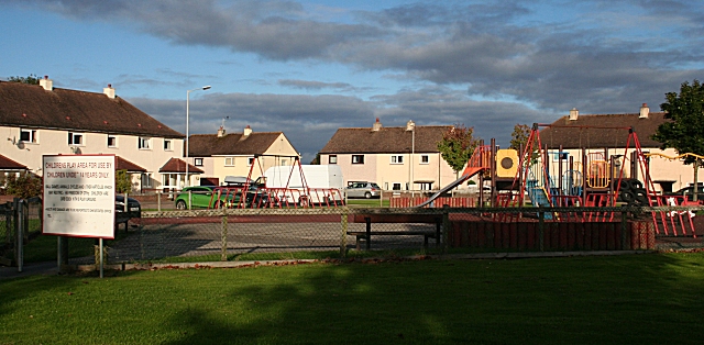
Image: © Anne Burgess Taken: 20 Sep 2010
In the background are the houses on Hermes Road. Nelson Square is a gap between Lossiemouth Road and Hermes Road, but there is no direct access from it to Lossiemouth Road, which keeps it relatively free of traffic. The large sign used to say that the play area is for use of children under 14, and lists equipment and activities which are forbidden, but many of the letters have fallen off, giving it a rather scruffy appearance.
Images are licensed for reuse under creativecommons.org/licenses/by-sa/2.0
Image Location
Latitude
57.661056
Longitude
-3.311951