Manor Farmhouse, Monkton Up Wimborne
Introduction
The photograph on this page of Manor Farmhouse, Monkton Up Wimborne by Mike Searle as part of the Geograph project.
The Geograph project started in 2005 with the aim of publishing, organising and preserving representative images for every square kilometre of Great Britain, Ireland and the Isle of Man.

There are currently over 7.5m images from over 14,400 individuals and you can help contribute to the project by visiting https://www.geograph.org.uk
Manor Farmhouse, Monkton Up Wimborne
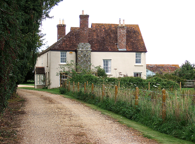
Image: © Mike Searle Taken: 17 Sep 2010
This is a Grade II listed rendered timber frame farmhouse, whose origins lie in the C16. Subsequently added to throughout the C17 - C19, it was apparently built on the site of, or close to an ancient chapel (according to the 1:25,000 OS map). The projecting chimney breast of flint and ashlar chequerwork is particularly attractive.
Images are licensed for reuse under creativecommons.org/licenses/by-sa/2.0
Image Location
Latitude
50.921505
Longitude
-1.976005