Wall feature incorporating millstone
Introduction
The photograph on this page of Wall feature incorporating millstone by Lairich Rig as part of the Geograph project.
The Geograph project started in 2005 with the aim of publishing, organising and preserving representative images for every square kilometre of Great Britain, Ireland and the Isle of Man.

There are currently over 7.5m images from over 14,400 individuals and you can help contribute to the project by visiting https://www.geograph.org.uk
Wall feature incorporating millstone
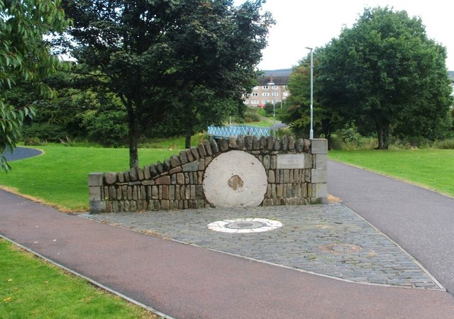
Image: © Lairich Rig Taken: 10 Sep 2010
The inscription to the right of the millstone reads "Mill of Haldane 2005 Community Project". Another inscription, on a nearby stone, explains that the millstones incorporated into this wall feature are "from the last water-operated corn mill in the Vale of Leven"; it also says that the mill was driven by water from Jamestown Dam, and that it was in use until 1942. The area is called Mill of Haldane on the map, but is generally only referred to locally as the Haldane. The OS Object Name Books (1890s) describe Mill of Haldane as "a small village having a corn mill, smithy and Toll Bar, the property of William McAlister and occupied by James Craig and others".
Images are licensed for reuse under creativecommons.org/licenses/by-sa/2.0
Image Location
Latitude
56.003137
Longitude
-4.573714