Howe of Alford
Introduction
The photograph on this page of Howe of Alford by Anne Burgess as part of the Geograph project.
The Geograph project started in 2005 with the aim of publishing, organising and preserving representative images for every square kilometre of Great Britain, Ireland and the Isle of Man.

There are currently over 7.5m images from over 14,400 individuals and you can help contribute to the project by visiting https://www.geograph.org.uk
Howe of Alford
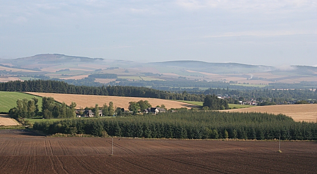
Image: © Anne Burgess Taken: 9 Sep 2010
A howe is an area of flat land, and the area around Alford is a classic example. It is fertile farmland, and played an important part in the development of agriculture. The houses in the middle distance are at Knowhead, and in the distance are the Correen Hills.
Images are licensed for reuse under creativecommons.org/licenses/by-sa/2.0
Image Location
Latitude
57.225159
Longitude
-2.711457