The ruined St Michael's church in Bowthorpe - view east
Introduction
The photograph on this page of The ruined St Michael's church in Bowthorpe - view east by Evelyn Simak as part of the Geograph project.
The Geograph project started in 2005 with the aim of publishing, organising and preserving representative images for every square kilometre of Great Britain, Ireland and the Isle of Man.

There are currently over 7.5m images from over 14,400 individuals and you can help contribute to the project by visiting https://www.geograph.org.uk
The ruined St Michael's church in Bowthorpe - view east
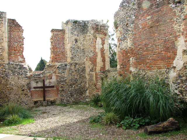
Image: © Evelyn Simak Taken: 12 Sep 2010
After extensive refurbishment in the 1630s, St Michael's church had dilapidated only a century later. Its chancel roof was removed in 1792. The round church tower was in use as a chimney for a brick-lined oven or a corn dryer and the structure was used for housing pigs. All that remains today are the chancel walls which are adjoined by the Church Centre > http://www.geograph.org.uk/photo/2062687 in the west and the garden of remembrance in the south. In the 1980s a skeleton was discovered sealed within the old oven.
Images are licensed for reuse under creativecommons.org/licenses/by-sa/2.0
Image Location
Latitude
52.635481
Longitude
1.216684