Dozzell's Well (site of), Finchampstead
Introduction
The photograph on this page of Dozzell's Well (site of), Finchampstead by Brendan and Ruth McCartney as part of the Geograph project.
The Geograph project started in 2005 with the aim of publishing, organising and preserving representative images for every square kilometre of Great Britain, Ireland and the Isle of Man.

There are currently over 7.5m images from over 14,400 individuals and you can help contribute to the project by visiting https://www.geograph.org.uk
Dozzell's Well (site of), Finchampstead
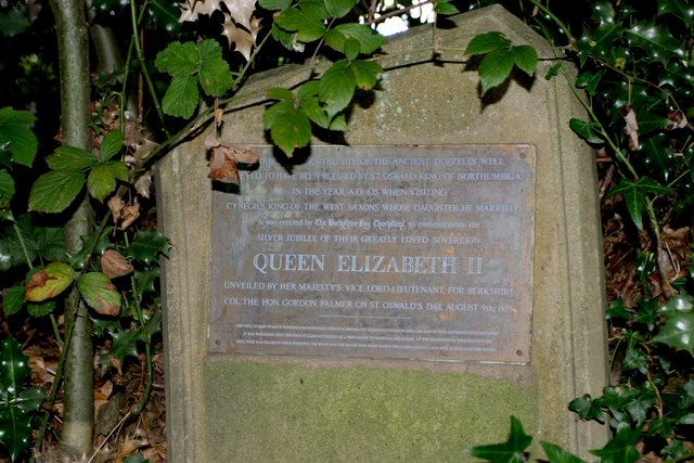
Image: © Brendan and Ruth McCartney Taken: 9 Sep 2010
This Well, opposite Constant Spring Cottage, was documented in various chronicles in 1029, 1098, 1100, 1103 and 1164. Regularly, the edge of the road would be wet but, sadly, the Well was destroyed in roadworks in recent years.
Images are licensed for reuse under creativecommons.org/licenses/by-sa/2.0
Image Location
Latitude
51.361655
Longitude
-0.872261